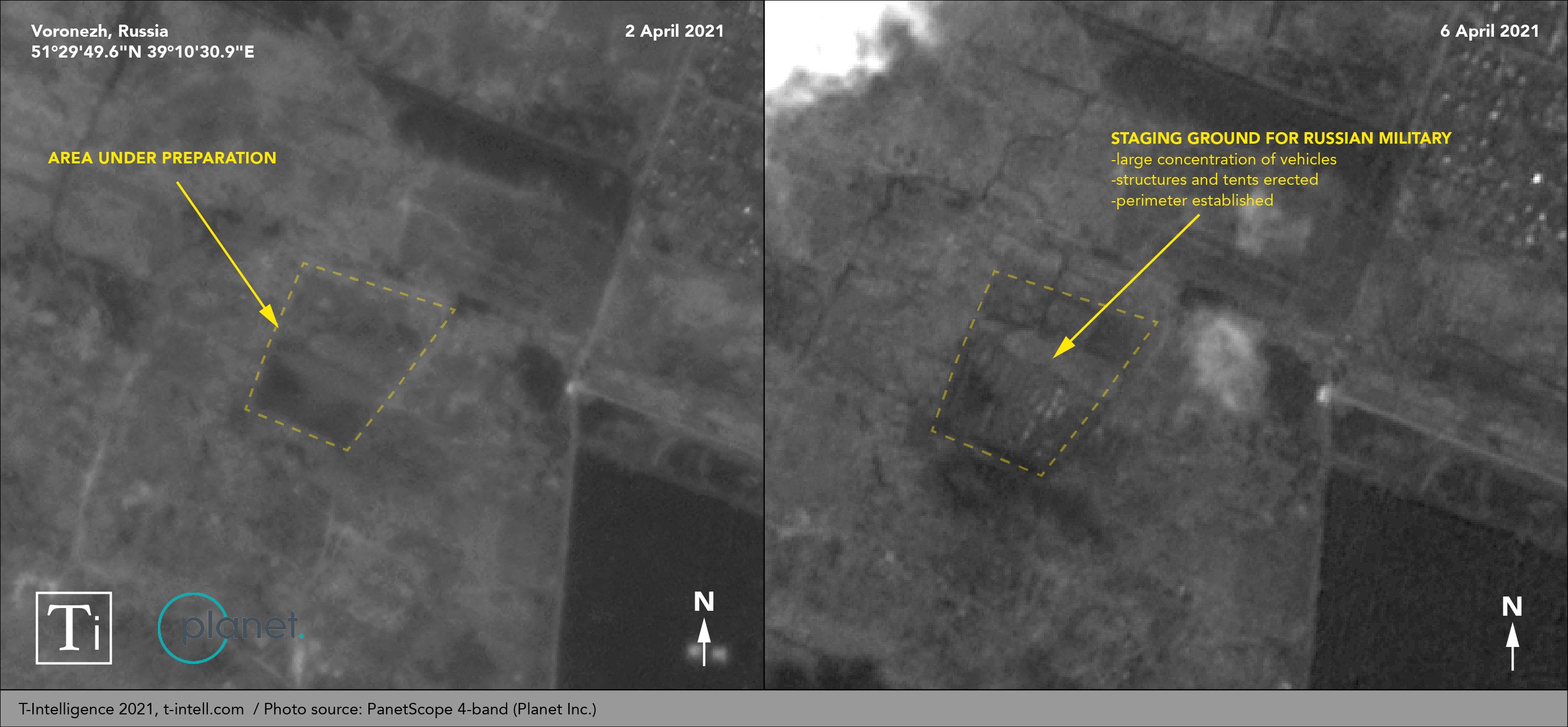
Geospatial intelligence (GEOINT) analyzed by T-Intelligence shows a Russian military staging ground in Voronezh oblast. The newly discovered site has the hallmarks of a logistics node that could sustain a line of communication to the Ukrainian border. A Conflict Intelligence Team (CITEAM) investigation revealed that many of the Russian military columns tracked by the OSINT […]
Posts Tagged
‘satellite imagery’
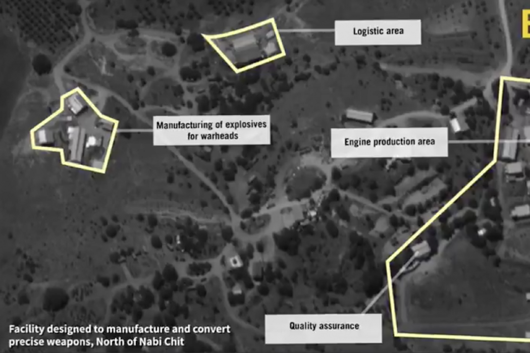
Satellite imagery shared by the Israeli Defense Forces (IDF) has revealed a precision missile factory near Nabi Chit, Lebanon. The facility is likely operated by Hezbollah with financial and technological assistance from the Iranian Revolutionary Guards Corps’ (IRGC) irregular warfare and external branch, the Quds force. Here’s a picture worth a thousand missiles: We can […]


